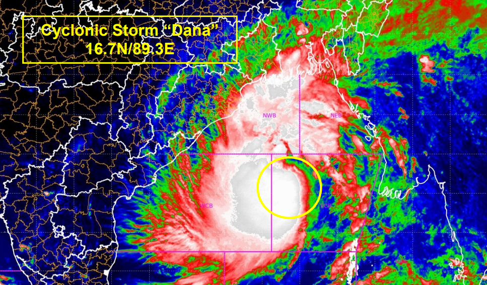
Bhubaneswar: Cyclone Dana, currently intensifying in the Bay of Bengal, is expected to make landfall between the Bhitarkanika and Dhamra regions between the night of October 24 and the morning of October 25, according to the India Meteorological Department (IMD).
IMD scientist Umasankar Das, briefing the media, stated, “The cyclone is projected to hit Bhitarkanika and Dhamra with wind speeds of 100-110 kmph, gusting up to 120 kmph, from the night of October 24 to the morning of October 25. As a result, northern districts of Odisha, including Kendrapara, Bhadrak, and Balasore, will experience intense rainfall on October 24 and 25, with rainfall subsiding from October 26 onward.”
Fishermen have been advised to return to shore, as coastal wind speeds are expected to increase from today. Das further emphasized the importance of taking precautionary measures, given the adverse weather conditions.
According to the latest IMD bulletin, Cyclone Dana is currently moving northwestward at a speed of 15 kmph and was centered at 8:30 am over the east-central Bay of Bengal, about 520 km southeast of Paradip (Odisha), 600 km south-southeast of Sagar Island (West Bengal), and 610 km south-southeast of Khepupara (Bangladesh). The cyclone is expected to intensify into a severe cyclonic storm by the early hours of October 24 and will likely cross the north Odisha and West Bengal coasts between Puri and Sagar Island, making landfall near Bhitarkanika and Dhamra.
State authorities and disaster management teams are on high alert, with evacuation plans in place to mitigate the storm’s impact in the affected areas.


