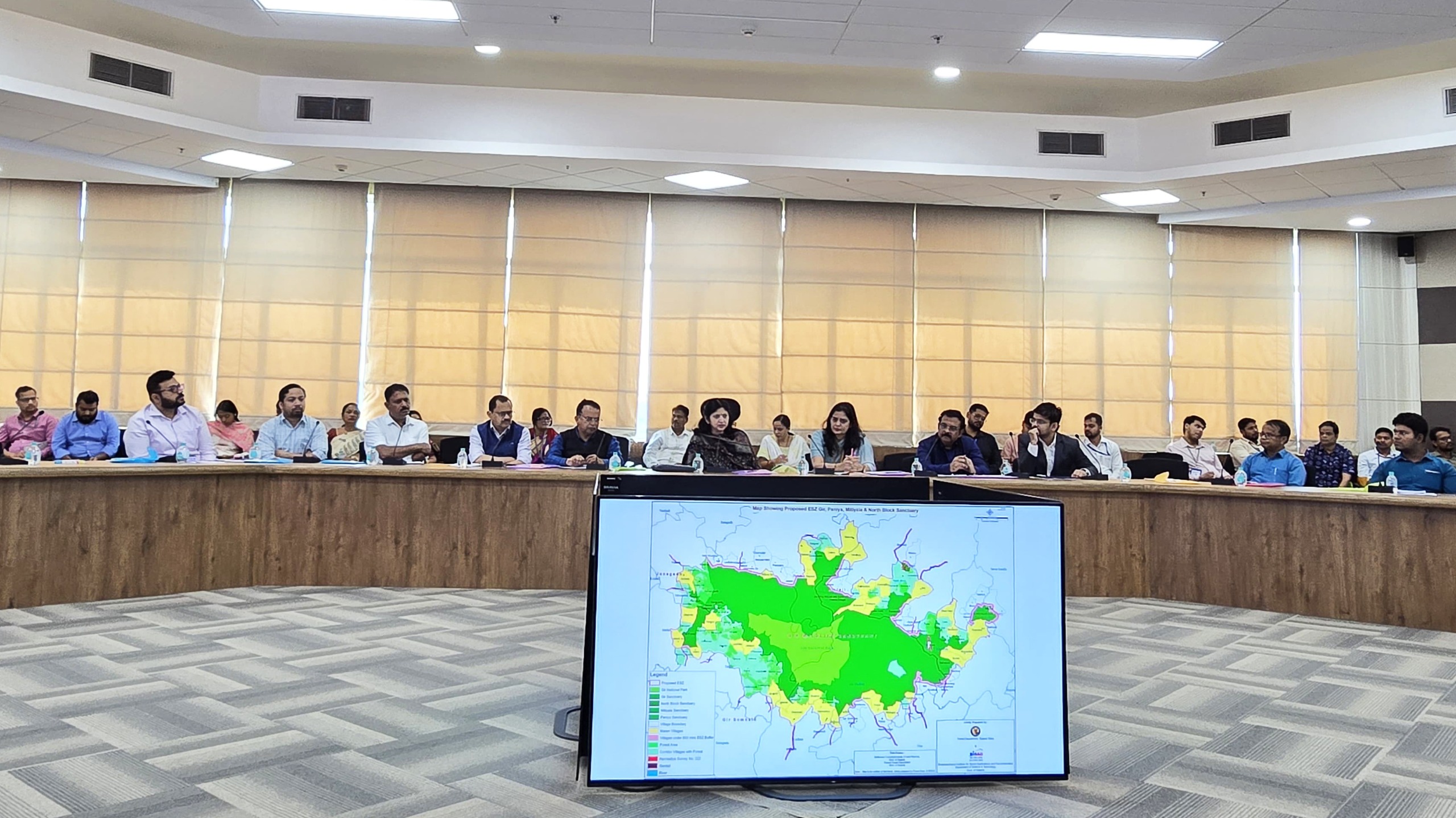
Bhubaneswar: The Commerce & Transport Department of Odisha today organised a key workshop on PM GatiShakti, marking a major step towards adopting a Geo-Spatial Logistics Planning Framework to strengthen coordinated, data-driven infrastructure development across the State. The session provided hands-on training to officials from several departments on using a unified geo-spatial digital platform that allows multiple infrastructure projects to be planned and executed simultaneously.
Addressing the workshop, Principal Secretary of the Commerce & Transport Department, Usha Padhee, highlighted that geo-spatial intelligence is poised to become the backbone of Odisha’s long-term infrastructure strategy. She noted that modern governance demands close collaboration among transport, industry, ports, logistics, mining, and urban and rural development sectors. By analysing project requirements, land assessment, logistics gaps and multimodal connectivity on a single digital map, the State can accelerate approvals, reduce costs and eliminate planning overlaps.
The integrated geo-spatial platform brings together logistics corridors, road and rail networks, port linkages, industrial clusters, utilities and land datasets, giving departments the ability to prepare scientific DPRs and identify connectivity needs with greater precision. Odisha is moving away from fragmented project-level planning toward a future-ready, interconnected model where infrastructure development aligns seamlessly with economic priorities, industrial expansion and citizen convenience.
The workshop was conducted in collaboration with the Department for Promotion of Industry and Internal Trade (DPIIT), Government of India, and BISAG-N (Bhaskaracharya National Institute for Space Applications and Geo-informatics) under MeitY. PM GatiShakti aspires to reduce logistics costs and ensure smoother movement of people and goods through multimodal and integrated planning.
Usha Padhee chaired the meeting on developing the State Integrated Logistics Master Plan. Kaustav Dipta Pany, Commissioner Rail Coordination, briefed participants on recommendations received during the State Master Plan workshop and explained how the GatiShakti Portal will guide coordinated planning. T. P. Singh, Director General of BISAG-N, assured full technical support to the State for expanding the platform’s capabilities.
Odisha will continue to enhance institutional capacity, promote stronger inter-departmental collaboration and deepen the use of digital mapping tools. The State aims to make the Geo-Spatial Planning Framework the foundation of its master plans, multimodal logistics projects and long-term investment strategies, ensuring a more efficient and future-ready infrastructure ecosystem.