
Bhubaneswar: The India Meteorological Department (IMD) on Sunday said a low-pressure area is likely to form over the Southwest Bay of Bengal within the next 48 hours, even as several districts of Odisha are expected to witness thunderstorms and rainfall over the coming days.
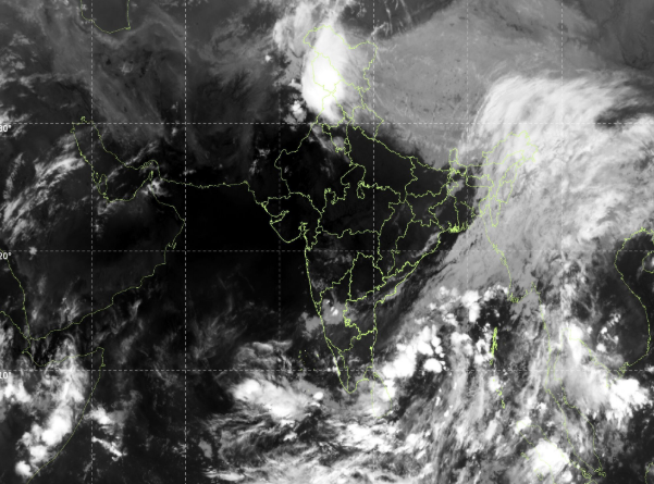
According to the IMD, an upper air cyclonic circulation persisting over the Gulf of Mannar and adjoining Sri Lanka is likely to trigger the formation of the low-pressure system over the Southwest Bay of Bengal.
The weather office said scattered to broken low and medium clouds with embedded intense to very intense convection are prevailing over the South Bay of Bengal and Andaman Sea, while moderate to intense convection activity has also been observed over the north and central Bay of Bengal.
Under its influence, several parts of Odisha are likely to experience thunderstorms accompanied by lightning and gusty surface winds till May 15. The IMD has issued a yellow warning for districts including Mayurbhanj, Keonjhar, Sundargarh, Jharsuguda, Bargarh, Sambalpur, Ganjam, Gajapati, Rayagada, Koraput and Malkangiri.
The regional weather centre in Bhubaneswar also forecast light to moderate rainfall at several places across the state till May 17.
Meanwhile, the IMD said the maximum temperature across Odisha is likely to rise gradually by 2 to 4 degrees Celsius after the next two to three days.